Korpijaakko

– my personal views on all walks of outdoor life

Tag Archives: Käsivarsi

Quick Hike Around Käsivarsi Wilderness

This is “one from the archives” i.e. one of those trips I did but haven’t written about. But it was such a nice trip, it deserves to be blogged about and I thought now would be a good time since I’m again on my way to the same area…

Last year I was guiding a packrafting trip to Reisadalen and as I had some free time before that, I decided to go for a quick stroll around the Käsivarsi Wilderness area.  I had very rough plan of walking first to East, then up North and at the end returning to Kilpisjärvi. A simple trip without several kilos of packrafting, glacier travel or polar bear safety kit was a welcome change. Just a simple hike with light gear: HMG backpack, minimalistic tarp, “fancy feast” stove, etc. I even left the DSLR home in favour of a lighter point-and-shoot. So, here’s the story from that simple walk:

I arrive to the luttle village of Kilpisjärvi late in the afternoon on Sunday 30.8. I shoulder the delightfully light pack and start walking along the trail towards Terbmisjärvi hut. I had hoped to have a full day of hiking but work commitments turnnit into only a few hours of daylight.

The walking is easy, though my mind is still wandering and occasionally I stumble on the worn and rocky path. It’s quite warm for the final days of August this far North. There are some bugs along the birch woods and I wonder if it was a mistake not to pack the headnet and repellent. But usually you don’t need them this time of the year and once I get out from the bush to the higher ground the bugs are gone and won’t be bothering me again.

The 16km walk takes little over three hours and I’m pitching my tarp in good time near the Terbmisjärvi hut. The open hut would be empty but I want to see if the minimalistic 3×1,5m tarp actually works for me in open terrain. And with tarp you are way more connected to your surroundings than while in a tent or hut. I cook dinner, enjoy a beautiful moon rise and later admire an owl who soars around my tarp silently and gracefully.

I woke up to a drizzle the next morning. The tiny tarp has kept me dry and I’m ready for a new day, even if it seems to be a grey one. With minimal gear the morning chores take very little time and I’m on my way around 08:30.

I had planned to follow the valley East and then up thru Kutturakuru pass but with the light pack I’m tempted to head straight over the peak of Jollanoavi (1023m). On my way up I play hide-and-seek with a curious stoat (Mustela erminea) before reaching the summit. The clouds mess the views but it’s still nice to be on top of a big hill. It always is. I head down and meet two hikers who by coinsidense happen to be fellow bloggers Mari and Markus. A small world.

At lake Japmajavri the sun finds it’s way through the clouds and the views open. It’s beautiful, quiet and I have that good solitary feeling you get from traveling thru remote wilderness. I make a little detour North-East to wade across the Poroeno river from a safe place. Easy but long and cold crossing. Once my feet are warm again I stop for a coffee break. It’s close to 18:00 and this is the first proper break of the day but why stop if you are feeling good walking?

Bad bush steers me closer to Valtijoki and I can see my course crossing with a tent pitched on the river bank. I’m not really in the mood for meeting other people but prefer dry feet and easy going over solitude. At he campsite I meet a man who is half-way into his four week solo trip – without food! Instead of food he has a flyfishing kit snd plenty of spices. He has been fishing and foraging for over two weeks and seems to be living his dream: There’s an aura or satisfaction and happiness, and a constant smile. After a longish chat I continue up the Valtijoki feeling happy for meeting the man.

Valtijoki is a beautiful creek and there’s a good trail following it on the sand ridge. As expected, the waterlevel is a lot lower than the last time I was here with a packraft in July 2011. Around 21:00 I find a good spot to camp. There’s some dead wood by the river so I make a small fire to cook dinner and decide to cowboy camp by the river without the tarp. Close to midnight it starts to rain and I find myself hastly setting up the tarp in the dark with a headlamp. Would’ve been a lot easier to do it in the evening… Once under the tarp I fall asleep to the sound of water rushing over the rocky drops of Valtijoki. Over 31 kilometers off-trail in a day makes falling asleep easy but I wake up a few times being cold and adding layers. Apparently the long day has also eaten into my energy reserves.

In the morning the sun starts to warm my black sleeping bag and I sleep well past the alarm and wake up around 09:00. Two hours later than planned! There’s a damn cold wind straight from the North but otherwise the weather is nice. I continue up along the Valtijoki. The scenery is great and there would be plenty of excellent camp sites. After crossing the river I head to the open Kopmajoki hut for a coffee break. I meet a lone hiker with fishing kit on a two-week tour. Only few people wander in the remote parts of Käsivarsi and those who do, seem to be going solo, on a longer trips and often fishing…

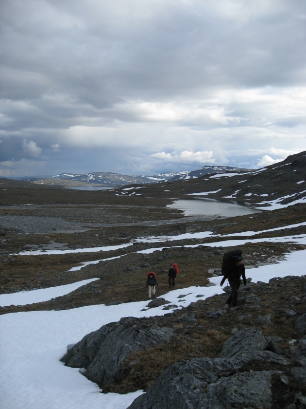
From the hut I decide to hike up to the Ritnicohkka (1317m) which is actually the highest peak in Finland. The highest point of Finland is merely a point on the slope of the Halti fjell with the peak itself situated on the Norwegian side of the border. I follow the wide ridge from stellite peak Ritninolka and in the end have to scramble through some steeper slopes. I walk thru a barren landscape of grey rock and over patches of white snow. I sit down, admire the views to North-East and really enjoy being up there. Little later I’m on the summit in the jaws of the relentless wind. Everything is frozen, the  temperature is well below zero and the wind feels very cold. I put on my puffy jacket and seek shelter behind the shed on the top and have a little break taking photos and sending a text message back home.

From Ritnicohkka I continue towards the actual summit of the Raisduottarhaldi (1361m), some two kilometeres to North and into Norway from the highest point of Finland. There’s a funny squeeky sound coming from my kit which I can’t localize despite checking my kit for stowaway lemmings. Soon the clouds roll in making navigation difficult and hiding the views. I adjust plans accordingly and head a bit more to the West until I meet the trail leading to the highest point of Finland (1323m) and walk up there to sign the book. No point of going for the actual summit. Near the border cairn there’s a book with a running number for visitors. Even though it’s not exact it gives an idea of the popularity: my number this time is 120066. The last time I was up here was in 2008 and then my number was 91203. Around 30000 vitits in the last eight years.

It’s still humid and cold and the wind is blowing. I hurry down from Halti to reach the open huts in the valley before darkness falls. The cozy old little hut seems to be empty so I head there. I really like it. It’s one of my favourite wilderness huts. And as the cold wind keeps on blowing, I’m happy to spend the night inside instead of sheltering under the bit-too-small-for-me-but-very-light tarp. I fetch water from the stream, light a fire in the stove and light the candle I brought with me and settle in while rain patters the single window. It’s warm and cozy inside. This night I don’t mind being little less connected to my surroundings.

Going thru my gear in the warm hut I find a reason for the weird squeeky sound that started while descenting Ritnicohkka: the soles of my trail runners are vetically broken between the heal and ball of the feet. They are worn and beaten anyway so it’s not a surprise but it means that for the return journey, I’ll stay on the trail in case of a catastrophic failure.

I don’t sleep too well. The hut feels too warm and the wooden platform feels hard as I only brought a thin short pad to save weight. Despite the discomfort I sleep until 09:00. Apparently I’m tired from the long days of walking. After morning chores I’m ready for the final 50km walk to Kilpisjärvi. I have an idea of walking it all in a one go as the trail is reasonably easy to follow even in the dark. My legs feel stiff and tired but soon pick up the rythm and I enjoy the downhill walk in the sunshine. Weather is good, views are good and going is easy. No reason not to enjoy.

Around midday I arrive to Pitsusjärvi hut. There’s a man sitting outside on the porch and he greets me with a question: “Do you have cell phone coverage?” It turns out his knees are in bad shape and he’d like to fly our with a float plane but doesn’t have signal to make the call. His brother is up on the nearby hill searching for signal. There’s no phone coverage in the valley but luckily I happen to have my satellite phone with me.  I have it for guiding remote ski expeditions and don’t usually carry it on summer trips in Scandinavia but decided to take it with me this time. A happy coinsidence.

We wait until the second man returns from the hill. He didn’t have any luck of getting signal so we make series of calls first asking for the number of the floatplane service and then trying several times before getting thru. I have plenty of time to eat snacks and drink coffee.

Almost two hours later I depart from the hut and from the Southern end of the Pitsusjärvi lake I can see a small plane approaching the hut and landing near the shore. I’m not too happy for loosing nearly two hours of daylight but I’m happy that I could help some fellow hikers in need. I guess my concentration is not at it’s best as I walk off from the trail and miss a bridge. A mistake I’ve made also back in 2008 in the same place. I backtrack, cross the bridge and blaze down the trail towards South and Kilpisjärvi.

Near the mighty cliffs of Meekonpahta I notice a lonely rucksack on the side of the trail. I look around but can’t see anyone. I assume someone has left it there to visit a nearby summit. There’s a short section of duckboards which makes going fast and easy and I soon catch up with a group of four hikers. One of the group is not wearing a backpack but is insted wrapped in emergency blanket.

Soon I find out that she had slipped and broken her wrist and they are on their way back to the previous hut. We arrive to the Meekonjärvi hut in no time and I hear that someone has already headed higher to search for signal to make an emergency call. I offer to make a call with my satphone and call to the Emergency response center in Kerava, near Helsinki. They are first taken aback for me calling to them from Lapland but the normal 112 doesn’t work from a satphone… They reconnect me to the center in Oulu that oversees the Northern Finland and I get to know that a helicopter will be send to get the lady to hospital.

In less than an hour a Boarderguard helicopter arrives to the hut, lands nearby and the paramedics go in the hut to prepare the patient for the transfer. I chat with the pilots and the winch operator who seem to have really nice job. They were actually returning from another mission when being alerted here and that’s why they were so fast. After waving the helicopter goodbye I decide to utilize the little daylight that’s left by walking to the next hut.

The walking is incredibly good: The trail is easy. Views are good. The coolness and freshness of the dusk feel good. My feet are light and go on autopilot, the last 100 kilometers have thought them well. It’s already dark when I arrive to the hut so I decide to sleep inside. Instead of a mammoth 50 kilometer day I walked just the normal 30 km but this is how things roll.

The night in the hut was again too hot and the platform too hard. Beaten feet on hard wooden platform just doesn’t work. But in the morning I’m ready to continue and get the hike finished. I enjoy a lazy morning reading the guestbook before getting started with the final leg around 09:00. It’s cloudy and I don’t really care for the views. Instead I’m more interested in getting the boring trail walk finished.

There’s one more hut about midway to Kilpisjärvi and I have a coffee break there. I catch two hikers who left the previous hut earlier and they offer me some proper coffee, which is welcome change for the instant stuff I’ve been drinking. On my way to Kilpisjärvi I find few handfulls of ripe cloudberries and spy a willow grouse family in the birch woods for a while. Hiking on the worn trail feels dull and indifferent but when I arrive back to Kilpisjärvi I feel happy and tranquil. I remeber all the good feelings, the beautiful views and the solitude. There’s an aura of satisfaction and happiness.

A good hike.

– – –

A few additional photos in my gallery.

Opastettuja packraft-reissuja! / Guided packrafting activities!

This blog post about guiding services I am offering for summer 2015 is  in Finnish as the packrafting courses and tours I’m offering with set dates will be guided in Finnish as default. But if you’re interested in a course or a guided tour in English, feel free to contact me with e-mail and we’ll arrange something great together!

This post serves also as a “commenting area” as the comments on pages are disabled. / Tämä tiedote palvelee myös kommentointi- ja keskustelualueena, sillä info-sivuilla ei voi kommentoida.

Kesä 2015 packraft-kurssit ja -vaellukset

14-08-24EOS 6D8164_900

Vuodelle 2015 tarjoan seuraavia packraft-kursseja ja -vaelluksia:

Packraft-melonnan peruskurssit
– 22.-23.8.2015, Kymijoki, Etelä-Suomi: 22.8. perusosa, 23.8. jatko-osa
– 29.-30.8.2015, Kymijoki, Etelä-Suomi: 29.8. perusosa, 30.8. jatko-osa

Packraft-vaellukset
– 27.6.-5.7.2015, Ivalojoki, Pohjois-Suomi:  Hammastunturista löytyy rauhallista erämaata ja Ivalojoen legendaarisilta kultamailta taas vauhdikkaita koskia. Nämä on mahdollista yhdistää packraftin avulla. Kalastusmahdollisuus kiinnostuneille.
– 5.9.-13.9.2015, Nordreisa, Pohjois-Norja: Pohjois-Norjassa Reisadalenin mahtavassa rotkolaaksossa virtaava Reisaelva on kuin luotu packraft-melontaan. Parhaaseen ruska-aikaan, jolloin luonto on kauneimmillaan.

Lisätietoja kursseista ja vaelluksista täältä!

14-07-09EOS 6D7662_900

PS. Myös räätälöityjä kokeiluja, kursseja, retkiä ja vaelluksia on tarjolla sopimuksen mukaan. Räätälöityjen retkien saatavuutta ja hintoja voit tiedustella sähköpostilla!

(Ja jos mietit, että mikä ihmeen packraft niin vilkaisehan “Mikä packraft?” -sivua saadaksesi vastauksen.)

Racing Style – The Moskkugaisi Traverse

The first part of the “Hiking North” trip series (the Moskkugaisi Traverse) is done and after two days of pizzas, burgers and beer at friend’s place in Kilpisjärvi I’m feeling ready for the next trip (the Poroeno-Reisaelva packrafting). And before the next trip it might be good idea to share some initial thoughts from the first trip.

I have to say that the trip turned out being a bit harder than I expected but it was doable anyway and gave me an idea about the type II fun the Alaskan racers often talk about…

After some five hours of sleep we started the trip from Signaldalen at Thursday morning 09:30 a.m. and finished it to the roadside South of Kilpisjärvi at about 03:15 a.m. on Saturday morning. According to the Social Hiking map based on our Yellowbrick beacons we covered 119km and gained 3274 vertical meters of altitude. For me that feels like quite a bit too much as measured from a paper map the distance should be more like 90km, though the height gain seems right. But on the other hand the beacons seem to be on right places and GPS shouldn’t lie. So who knows, maybe we covered 119km in 41,75 hours?

We started from the parking area at the bottom of the valleys and started to walk up the trail to the peak of Bárrás.

After visiting the peak we ascended back to our backpacks and started the walk towards the rest of the peaks hauling our backpacks up to a pass at 1063m and visiting the Pältsan from there.

After summiting the Pältsan it was very clear that we had underestimated the time needed for hiking over 3000 vertical meters (of which well over 2000 meters with 15 kg backpacks). This meant that we couldn’t start the high route traverse of the Moskkugáisi during that day as it wouldn’t be wise to do it in the dark and camp sites are hard to find up on the ridge. So we camped on the fjell side: two man under a small one-man tarp… I also had a summer weight sleeping bag and as the temps were below zero had a bit cold night.

We left the camp at 07:00 a.m. and headed up to the Moskkugáisi followed by a spectacularly scenic high traverse to the ridge leading to Juoksvátnjunni.

The last peak to visit was the Juoksvátnjunni with cool sharpish rocky ridgeline leading to the summit.

After the last summit we walked to the trail leading from Pältsastugan to Kummavuopio, walked a bit along the trail and then inflated our packrafts and started the float down along the Kummaeno river.

To our surprise the Kummaeno offered quite poor packrafting. It was fun for a while but soon we got frustrated with the very rocky rapids and several sections too shallow for packrafting. The going was also slow and we were again running out of daylight. And we were also miserably wet and cold. We took out at the edge of Oaggujeaggi bog, made a quick fire using a gas stove as a lighter and had a proper one-hour break with hot food (the first and only proper break excluding the camp).

After the break we packed the rafts and started walking along the trail to the abandoned farm of Kummavuopio. From Kummavuopio we headed towards the road on the Finnish side of the border following very wet snow mobile trail and doing two river crossing with packrafts in the dark and enjoying a section of quite bad brush between the rivers. This was then followed with a  few kilometers of forested uphill to the road where a friend picked as up at 03:15 a.m. (Sorry, no photos from this sections as it was dark and I was tired and too busy to get the trip finished.)

I have to admit that I was quite tired after the trip but I did enjoy it in a twisted way. I don’t really recommed doing the trip this way but as it’s a spectacular route in my opinion I’ll be writing later about better ways to do it…

– – –

The Social Hiking map gives you a good idea about the trip but I forgot to use the #HikingNorth hashtag on some tweets so it’s missing some tweets but the missing ones are available from the Yellowbrick YBlog page. Pictures linked to the map are coming later when I get the two other trips done…

Plans for the summer: The Finnish packrafting epic?

For the last three weeks I have been teasing you with my trip plans for this summer. I’ve been given several clues but apparently the guessing  was too difficult as there were no right answers. So, it’s time to reveal the bold plans!

But first… the winner of the competition!

Even though there were no 100% correct answers I feel like that Yeti deserves the promised free meal and dessert as he was the first to guess that I will be packrafting. Yeti’s guess was that I would be packrafting from Kilpisjärvi to Tornio along the Swedish border, but this is not quite it… Congratulations Yeti!

Oh, and if you haven’t done it yet, check Yeti’s superb bikepacking blog!

And why there is a question mark?

There is a question mark at the end of the title. That is because I feel that the word epic starts to be somewhat over used and it is in the danger of loosing meaning. For me the word epic is reserved for the state-of-the-art of each method/style of travel on each distinct regions. For example I wouldn’t call my annual three-day spring kayaking trips epic, they are just nice and relaxing weekenders with good friends.

Kayaking in the Jongunjoki river in May 2010. Not epic but really good time!

But unlike kayaking packrafting is relatively new sport in Finland. I know that few people have been packrafting in Lapland for some years and for example Mikko Kilpeläinen has been blogging about his trips (In Finnish only, sorry!) and I’m sure we can soon read about Hendrik’s packrafting trips from his Hiking in Finland blog. But to my knowledge no one in Finland has done the kind of trip me and my friend Tuomas are planning to do. So, I leave the question about epicness of this trip to you dear readers. Is it epic or not?

The Finnish packrafting epic 2011

And here it is!

We plan to take the route drawn to the picture below. You know that you are doing something cool when you have to use 1: 500 000 map to make the route fit on the computer screen…

The route of the Finnish packrafting epic 2011!

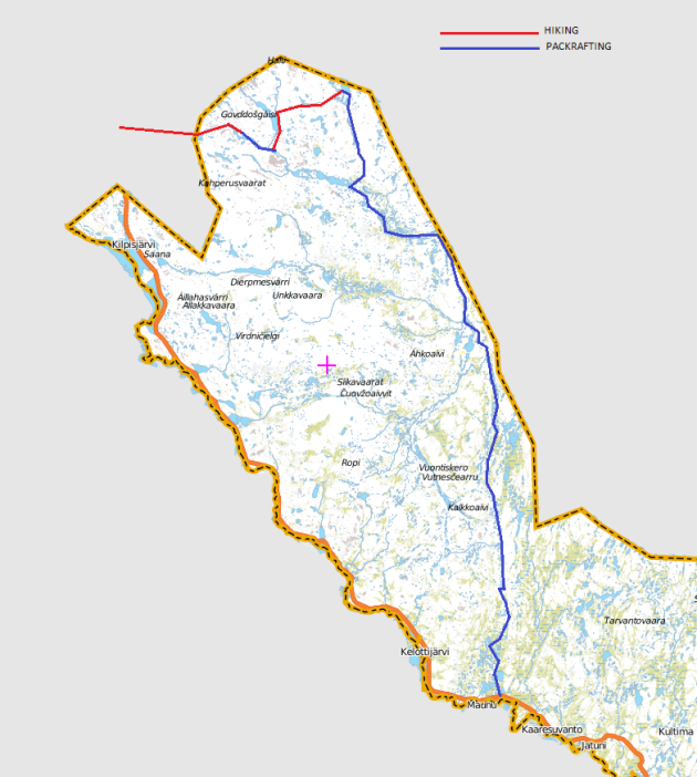
As I told earlier we plan to start from the Norwegian side of the border North to Kilpisjärvi. From there we will follow Didnujohka river upstream to the border and cross the border. From the border we will follow Urttasjohka river down stream but it is too small to be rafted in July. After some hiking the river turns into a lake system which should be raftable. The first lake is about 40 meters above our take out point so there should be reasonable current, and maybe some drops requiring portaging, to get a feeling how the boats handle in heavy load. On the eastern shore of Vuomakasjärvi lake we will deflate the boats and start to hike along the Kalottireitti (Nordkalottleden) to Pitsusjärvi lake where we will take a turn to East to Somasjärvi on the border between Norway and Finland.

If the water level is unusually high (for example because of heavy rains) we might – instead of walking straight to Somasjärvi – walk to the  Halti fell (the highest place in Finland) and try to packraft back to Pitsusjärvi. The small river, Govdajohka, that runs from the base of the Halti is under 10km long but drops 186 meters on the way! This means a lot of portaging but luckily we can scout the river while walking upstream. If we end up rafting the Govdajohka we will end up back to Pitsusjärvi, pack up the rafts again and head to Somasjärvi along the trail. But it might be that we pass the Covdajohka option…

The rocky Govdajohka in the background and Pitsusjärvi behind the fells. Hiking to Halti at the end of June 2008.

From Somasjärvi starts the Valtijoki river which is about 25 kilometers long and drops about 150 meters on the way to Porojärvi lake. It is likely that we’ll have to do quite a lot of portaging to bypass big drops and hard white water but luckily packrafts are light to carry! Valtijoki is too small and rocky for traditional white water rafts but it’s possible to paddle it with a white water kayak. This happens occasionally but I don’t think that the river is runned even yearly, maybe biennially or so. The main reason for this is that the river is in the middle of nowhere so it’s hard to access and safety aspects are also challenging. Experienced paddlers describe the river in the following words (translation from Finnish by me): “Valtijoki can be considered as one of the most challenging river routes in Finland. – – For a beginner the river may turn into a nightmare-like fight for life but for an experienced boater with a solid kayak roll it is higly recommended as a “once in a lifetime” trip.” Frankly said, we are a bit unsure if we are trying to bite more than we can chew here – but with packrafts there is always the option to walk.

The Valtijoki ends to Porojärvi lake and from there starts one of the most classic wilderness river routes in Finland. It starts as a Poroeno river which is about 44 kilometers long and drops 135 meters on the way. There are few dangerous class IV rapids that likely require portaging and a lot of easier white water to enjoy. After this section Rommaeno river joins the Poroeno forming the Lätäseno that continues 70 kilometers all the way to the village of Markkina on the border of Finland and Sweden, dropping 118 meters on the way. There are few dangerous class IV and V rapids in Lätäseno that require portaging but there are also long stretches of smooth backwater. The river route from Porojärvi to Markkina is quite popular to do with a white water raft, canoe or kayak. The boats are usually flown to the lake with helicopter or plane. Our trip will end to the village of Markkina after some 200 kilometers of wilderness travel by foot and packraft. After the trip Tuomas will head back to South but I plan to stay in the North for week more. My girlfriend will join me and we will head to Swedish Lapland for a summer hike, and maybe for some more packrafting… 😉

We plan to do the route in eight or nine days, depending on a few things. In the beginning the packs will be quite heavy with food for nine days and about 5-6kg of rafting gear each. I’ll post detailed gear list and menu when I have them figured out. We are going to start in either July 8th or 9th and end the trip the next weekend. As the July is somewhat the official month for summer vacations month in Finland we might meet some friends along the way. My colleague will be fly fishing at Valtijoki at the same time so we might get some fresh fish along the route but we plan to be self-sufficient. There is also group of friends rafting the Poroeno-Lätäseno river route with a traditional white water raft (flown in by helicopter) and if we are quick enough we might meet them along the way and float the final stretches together. The major uncertainties, in addition to the water level and raftability of some parts, are related to the logistics as our starting point is about 150 kilometers from our ending point and bus schedules in the North are crappy. But if we don’t come up with anything better, we’ll solve the problems with hitchhiking.

So, if we can pull this together… Could this be called an epic trip?

Psst! Jyrki and Joel from Loimumedia paddled the Poroeno-Lätäseno route with a canoe and documended it. First they hauled the canoe to the starting point in March and came back in July to ride down the river. Respect for not using motors! You can buy the DVD from their website but the trailer is of course free so here you go: