Jaakko Heikka - Professional wilderness guide and diehard outdoor enthusiast with a special interest for lightweight backpacking, arctic expeditions and outdoor photography.

For more pictures, visit my gallery
In collaboration with…

– my personal views on all walks of outdoor life
In June me and N traversed Kebnekaise (2100m or so), the highest peak of Sweden. It’s a classic hike with parts following the wide path from Nikkaluokta to Kebnekaise Fjällstation and parts following the hugely popular Kungsleden trail. The marked trails and well equipped huts can make a nice hike in spectacular Alpine scenery. But I seem to be incapable of going “only” for a nice walk.

Instead I usually come up with a stupidly big unconventional plans. This time the plan was to start from Nikkaluokta, hike over the Kebnekaise (1700 vertical meters mostly with huge backpacks), then head further North to packraft river Aliseatnu (no idea if you can paddle it but looks reasonable on aerial photos) and then hike back Southward to float the Visttasjohka river back to the car. Pretty awesome plan, eh?
To enjoy good flows for packrafting going early in the season is good idea but this year summer was seriously late which meant plenty of snow on the trail (snowshoes needed), cold nights (a bit more insulation) and cold, fast and bloated rivers on the week after the summer solstice. Not far away people were still skiing and driving snow scooters… As you can guess, with these conditions it doesn’t always go as planned.

After a late camp, approach from Nikkaluokta and a great breakfast at the Fjällstation N was the sound of reason and said that hiking up the “Västra leden” (Western route to Kebnekaise) with 25kg backpacks was a stupid idea. Well, it probably was. So instead we traversed to the Eastern side of the mountain. Scratch the original plan, but there was a backup…

The highway on the approach from Nikkaluokta to the Fjällstation.

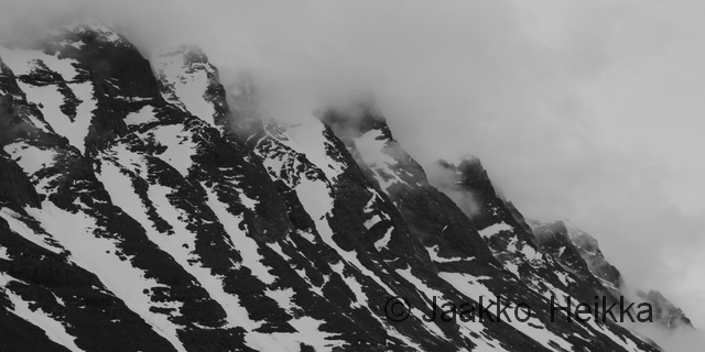
It would’ve been up that way and over the peak in the middle and then to the actual summit…

The next day we tried to approach the summit from East along “Durlins led” but we started too late and sinking into the wet snow with our snowshoes, watching the cornices rumble down from the cliffs on both sides N pulled the plug again and we returned to camp. No summit this time. Probably a good decision.


I’ve read that Singgivaggi has good campsites by the lakes… What lakes?

And judging from the still frozen lakes and stories told by other hikers we met on the trail, packrafting the Ailiseatnu river would probably not work either: the lakes would still be covered with ice and river probably too dangerous due ice and flooding. So scratch that too. Instead we hiked a short day to Sälkastugorna huts and solaced ourselves with some extra rations from the small shop, a sauna and soft beds. Not a bad way of spending a holiday either but why do the conventional option when you can try an unconventional one?

The next day we decided to take a shortcut to Visttasvaggi valley through Stuor Reiddavaggi valley and past the majestetic mountain Njallu. We ended up walking most of the way on snowshoes hauling packrafts as sleds but we didn’t mind as it worked really well. The rain and clouds hid some of the scenery a bit but it was still beautiful.

Proper winter in Stuor Reiddavaggi in late June.

The next day we started with a short day hike upstream from Visttasstuga hut to packraft the upper part of Visttasjohka river. The river was in full flood being faster and slightly more demanding than I had thought but not too difficult. With the silty water rock contacts were unavoidable but swift and harmful. At the hut we packed the rest of our kit on the rafts and headed downstream.

N floating on the upper parts of Visttasjohka.

I knew the river would be quite easy from Nikkaluokta up to Lisa’s stuga and from the aerial photos I had noticed only one serious section of white water on the way to Lisa’s stuga. (It’s where the trail from Kaskasvagge crosses the river. Serious stuff.) Well, with the flood there were more difficult spots and in the strong current without any eddies we ended up to a section of big waves in a rocky bend. I’d say it was class 3 or so, not extremely difficult but too difficult for N who capsized and while I was checking on her I flipped too. After some time with rocks hitting my legs I decided a wet re-entry wouldn’t be good idea and swam ashore with my kit. N had manged to get to the shore as well so I paddled down stream to catch her raft. A moment later we were together on the shore, little bruised and scared but in one piece and with all our kit. N wasn’t any more in the mood for packrafting so I continued alone down to the bridge and from there on we hiked down to Lisa’s cabin, passing what seemed like excellent packrafting.


Part of the serious stuff after the bridge.
 The next day we paddled down from Lisa’s stuga to Nikkaluokta in great weather and with great speed: good flow and some back-wind plus a closing cafeteria helps a lot. In the end we did 9 kilometers (measured on map along the river) in 1 hour 25 minutes. That might be the fastest packrafting I’ve ever done if not counting short sections of rapids. With numb legs we stumbled towards the parking area and well deserved coffee and cake.

Lisa’s stuga: cozy open cabin with interesting history. Bring your own firewood.

You know it’s good when you have snowshoes and packraft.
For most of the week the weather was great and favourable but conditions were against us and maybe we just weren’t up to the task. I guess no one likes scratching but if you plan huge and fail, you can still deliver big. So it wasn’t a bad trip, and one day I might try it again with the “racing style” required to pull it through.
– – –
As usual, more photos in my gallery!
– – –
A footnote on packrafting the Visttasjohka:
If you are planning to packraft the Visttasjohka river, I’d recommend going with high water but after the floods of the spring this will vary between years. With the floods eddies are very few which makes either long scouting walks or committed paddling. If you start lower, you’ll need less water.
Study the aerial photos carefully and at minimum scout the section starting before the bridge mentioned above. And if you’re planning to paddle it, take proper white water kit. Also the bend about 2,4km upstream from the bridge (where we capsized) and the spot were Kaskasjohkka joins the Visttasjohkka are worth scouting, at least when water level is high.
The river drops 120 meters on 17,5 kilometers from the source to Lisa’s stuga and 40 meters on the 22,5km from Lisa’s to Nikkaluokta so speed is guaranteed if waterlevel is adequate. The river offers great packrafting but be carefull, we are not the only ones who have swum there.
Jaakko Heikka - Professional wilderness guide and diehard outdoor enthusiast with a special interest for lightweight backpacking, arctic expeditions and outdoor photography.
For more pictures, visit my gallery

Looks wild and wonderful. Top post and thanks.
Thanks Martin! Helps me to motivate to catch up with the backlog. Still one epic Svalbard trip to cover before heading up North. 🙂
What a beautiful wild adventure!!!!
Ciao Mattia
Thanks! Nice to hear you liked it. More stories and photos from a more recent trip soon!
I’ll wait for your new posts! Ciao!!
Very nice, I like your style of travel too! Love the photos, especially the elk!
The scenery is quite breathtaking and you have managed to portray it beautifully. That delicate blue on the horizon amongst the snow and the splash of red. Wow…fantastic!!
Thanks! It’s really beautiful area. 🙂
Pingback: Svalbard – Summer 2015 – Pt. 1 | Korpijaakko
Great trip and write up as always
Pingback: Kebnekaise Traverses – The One With Crampons | Korpijaakko
Pingback: Kebnekaise Traverses – The One With Paddle | Korpijaakko